Author Archive
What is squirrel cage rotor
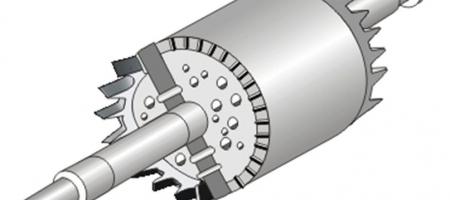
In this type of rotor, the rotor drum is provided with a number of circular holes, which are parallel to the shaft. Solid copper or aluminium bars are placed in these holes and all bars are welded
Working principle of sodium vapour lamp
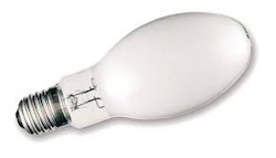
Scientists have long been familiar with fact high luminous efficiency could be obtained by the use of sodium resistant glass, the sodium vapour lamp has now reached the practical stage. Working and construction Principally the sodium vapour
What is wound rotor induction motor
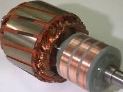
The rotor windings are star-connected like a three-phase star connected transformer. Rotor winding is present inside rotor drum. Rotor drum is placed on the motor shaft. Motor shaft carries three slip rings which are circular in shape
Why is single phase induction motor not self-starting?

When single-phase AC supply is given to stator winding. It produces alternating flux.i.e. which alternates along one space axis only. It is not synchronously revolving (or rotating) flux, as in case of 3 phase stator winding, the
What is split phase induction motor
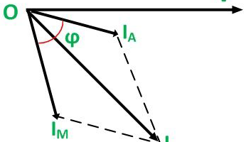
Split phase inductions motor: resistance star induction run Two winding are connected in parallel to supply to make 1 phase induction motor self-starting. One is main winding and other is staring winding. both these winding are 900
How to use the digital plannimeter to find area of an irregular ?

Preparation: paste or fix the drawing paper containing area on a drawing board. Place the roller at the positioning which will make a right with the main body. By tracing the outline of the fig. if any
What is modern survey method

In olden types surveying works, conventional instruments such as taps to measure distance, use of a prismatic compass to measure the horizontal angles, use of dumpy level to find the elevation between the points on the earth’s
Instrument used for chain surveying

The various instrument used for the determination of the length of the line by chaining are as follows Metric surveying chain Tapes Arrows Pegs Ranging rods Offset rods Plasterers’ laths and whites Plumb bob. Metric surveying chains
Applications of GIS

Resource and geological exploration Location of engineering structures such as bridges, tunnels or dams can do by studying the satellite imageries. The siting of storage reservoirs can be studied. The study of alternative sites for the alignment
Geographic information system
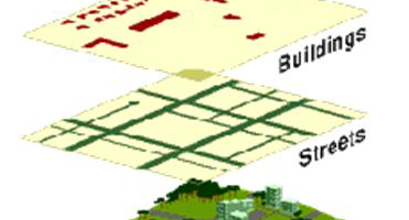
Geographic information system [GIS] is computer software which gives information of any discipline. It can be defined as an organized collection of computer hardware, software, geographic data and personally designed to efficiently capture, store, update, manipulate, analysis,